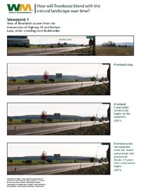
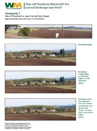
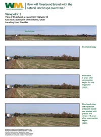
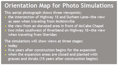
  Our long-term goal is for Riverbend to blend with the natural landscape. We took an important step in this direction recently by removing tarps and replacing them with soil and grasses. Additional aesthetic improvements are underway as we continue to cover the existing landfill and plant more grasses. By 2016, much of the existing landfill will be covered with grasses. The purpose of the photo simulations is to show how the landfill—including the existing landfill area and the expansion—will look to passersby and neighbors over time. Note: There will be very little change in the views of today and the next 15 years. 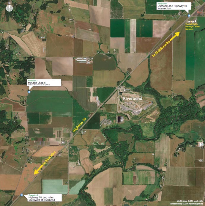
Print This Page |